
20 April 2016, The Far Reach, Anchored, Simpson Bay, St. Maarten

Anchored in Simpson Bay, St Maarten.
At 1400 on 19 April I slipped the mooring at Elephant Bay, St Thomas and sailed SE down the East Gregory Channel headed for open water. My destination was St Martin(French side) / St Maarten (Dutch side), about 105 miles due east as the crow flies. This is often considered a difficult sail as the winds and ocean swell can be big and the wind is almost always on the nose. It seems most sailors motor this passage. The Far Reach does not have such a capability so sail we must, regardless the conditions.
I had a short 2-3 day WX window based on forecasted winds to be NE and about 15-18 knots before the wind was expected to clock to the east and increase to 20-25 knots for the rest of the week.
The day before I planned to depart I returned the little Wifi hotspot I had rented and bought ice, some meat, and fruit. That afternoon, I hauled the inflatable on deck, washed the engine down and stowed it in the port cockpit locker. I washed the dinghy and left it to dry on deck, over night.
Next morning, I rolled the inflatable up, strapped it into its bag, and stowed it in the quarter berth. I spent the next hour in the water with mask and fins scrubbing the Far Reach’s bottom so she would be as efficient under sail as possible.
We went from flat calm that morning to a solid 15 knots by the time I was underway. It felt soothing to be sailing again, even if I was doing it alone.

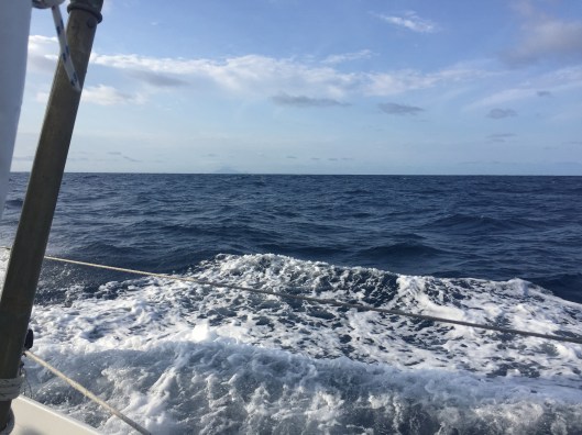
Sailing to St Maarten. It felt good to be sailing agin.
The first two hours were uneventful–just fine close hauled sailing, however, while making my rounds on the foredeck I happened to look up and immediately spotted a derelict and half sunk 14′ fishing skiff floating 50 yards away about two miles off the south west end of St John. I altered course, tacked, and investigated. The port side was ripped away and it looked like it had been in the water a long time. There was not much I could do. My handheld VHF radio would not reach anyone of consequence. And no one would collect it up anyway. So, I proceeded east sailing along the south side of the beautiful and picturesque St John, Norman, and Peter Islands. We had full cloud cover by then and the somber sky started to spit light rain. The swell was moderate. We were making 6-7 knots.

I spotted a half sunk skiff off the coast of St John island. It would be impossible to see it at night.
Darkness fell about 1930. I lit the kerosene navigation lights and then feasted on steamed rice. I turned on the new, but untried, AIS and placed it in the receive only mode to conserve power. The Far Reach sailed beautifully, just powering down the coast. She was quiet, strong, solid, and responsive. The Cape Horn wind vane was performing its magic perfectly.
Around 2200 the light rain stopped. Though there was still significant cloud cover, the moon beams managed to break through and cast a translucent silver light on the surface of the waters of the Anegada Passage. It was beautiful. I could see the pin-prick lights of civilization on Virgin Gorda off the port beam. We were were close hauled on port tack with working jib and a single reefed main and averaging 5-6 knots as the wind speed had dropped a bit. It was better to be slightly under canvassed at night, especially when single-handing. I set my timer for 20 minutes and cat napped on the starboard settee which held me snuggly due to our 20-25 degrees of starboard heel. Every 20 minutes I climbed the companion way ladder to make sure we were on course and perform a 360 degree scan of the horizon to make sure we were in no danger. I maintained this routine till we were well clear of Virgin Gorda.
A little after midnight, with nothing but open water for the next 75 miles I switched the AIS to transmit and went to sleep for about 90 minutes or so. I got up about 0200 and checked that all was well. I spotted a cruise liner off to the south with its massive white lights shining like a beacon. I checked to see if it was on the AIS. It was of course. I had the alarm set for two miles so it did not trip the alarm at 7 miles distance. I spoke to the a ship’s officer over my hand-held VHF radio asking if they had me on radar. They said they could see me fine. I made a last quick sweep of the horizon, then crawled back into my bunk where I was awed by the sounds of my fine ship tearing her way across deep water on her way to a distant island. I awoke about 0330 and checked that all was well and we were still on course. We had broken out from under the cloud cover and the three quarters moon illuminated the water and horizon in a magnificent silver glow. The visibility was fantastic. The wind was holding steady at about 15 knots from the NE. We were maintaining a heading of about 100 degrees magnetic. Perfect.
I crawled back in my bunk once again and slept till 0530 when I got up to listen to the Chris Parker’s 0600 wx report. I was disappointed that he did not mention the Far Reach during his 0600 broadcast. During our December passage he had provided very accurate personalized Wx info which we could hear on our small portable HF receiver. This technique only requires we send him a daily SPOT GPS location track. I suspect he must not have received our SPOT location this time. I will have to sort that out.

It was a lovely passage.
Regardless, about 0700, while sipping coffee and sitting on the bridge deck I happened to look up and there, right off the starboard beam, larger than life, was the rugged volcanic island named Saba about 20 miles to the south. Fabulous, I thought. I decided to take a look to the east over the top of the Sweet Pea, our 9′ Fatty Knees hard dinghy, strapped upside down on the cabin top. And sure enough, at 11 o’clock about 25 miles distance was St Maarten.
Saba on the horizon.

St Maarten, a welcome sight, about 25 miles away. Look just to the left of the shrouds.
We made it to about 7 miles from St Maarten on a single tack before the wind shifted 30 degrees to the east and that was that. I had to make two 40 min tacks grinding our way into the eye of the wind to reach Simpson Bay and I let go the anchor in 13′ of emerald green water.
I debated using the hard dinghy or the inflatable to clear-in to customs but finally decided to inflate and launch the inflatable as I think I’ll be here a couple weeks to get the recalcitrant halyard chafing problem under control.
Clearing-in was simple and straight forward. You can travel between the French and Dutch sides easily. I’ll start exploring tomorrow. All in all, this turned out to be pretty easy trip.

It is so nice to come back to your blog, which I have been following for years, and see you out there, I am just beginning my refit/restoration, and your blog just keeps inspiring me. Well done!
LikeLike
Scott, thanks for the kind words. It has been a great journey. All I can say is the refit will be tough but if you can operationalize your plan and sail to your vision it will be worth it. Good luck and happy grinding! LOL.
LikeLike